
Lockdown walking 2: Horley - Salfords loop
- Kate Cheema

- Apr 20, 2020
- 5 min read
I had grand plans for a mammoth expedition up via South Nutfield this weekend, but after what felt like a seven day working week (rather than 4), the lure of a lie in (ironically) and the good-key-worker-him-indoors working this weekend it was not to be. Instead I decided to stitch bits of a couple of regular loops together to give a lovely couple of hours out in the sun in a socially distanced and responsible way.
I'll call this one the Horley-Salfords loop, although it takes in a bit of Meath Green as well. Its a snip at just under 11km (6-and-a-bit miles) and took me almost exactly 2 hours, which is about average I think. It's a bit less green-and-pleasant than the Outwood Loop, but still has some lovely views and countryside to enjoy.
Once more (with feeling), from the top entrance to the train station, cross the road at the lights (safety first), turn right and then left down Station Approach. Follow the road round and cross over at the cross roads onto Smallfield Road. Head down the left hand side of Smallfield Road and take the second road on the left, Langshott Lane. Follow this quiet residential road round until you pick up a pedestrian/cycleway that cuts through the Lanshott estate. You'll cross over 2 roads before coming out onto Langshott Wood. Head straight over and go down Lake Lane which will take you through the Acres and onto an unmade track. Take a moment to marvel here; Lake Lane, and the land surrounding it, is thought to be part of the ancient Saxon grazing routes where animals would be brought down from the (drier) North Downs to graze. I kinda like the idea of following in 1,000 year old footsteps. Without the sheep obviously.
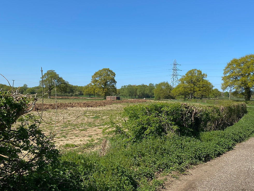
Pass Great Lake Farm (c. 16th century BTW) on your left and continue up Lake Lane. I like the peppering of WW2 pill boxes around this area, in fact the whole place has traces of centuries of history.
At the top of Lake Lane, take a left along Cross Oak Lane (no pavement, very little verge, occasional fast traffic) until you reach Orchard Drive. Over to your right you should see a gate to a footpath/cycleway/bridleway; its called Gail Lane but I didn't find that out until today (even though I've walked it a ton of times!). Go through the gate and up Gail Lane. Another rather marvellous pill box to your right, this one looks like its got a hair do!

Carry on up Gail Lane, a lovely shady path, until you reach Perrywood Sports and Social Club on your left. We're going to turn left at the 'public footpath' sign, but you can follow the path further up to Honeycrock Lane, cross over and continue up to Whitebushes and Earlswood. Another day.
Turn left at the 'public footpath' sign and follow the path over the railway bridge and down to the entrance to Salfords Station. This was built as a 'halt on demand' station in 1915 specifically to service the repurposed Monotype works, which made munitions and components for the war effort, situated on Honeycrock Lane (now Perrywood industrial estate) during WW1; it didn't open to the public until 1932.

Cross over the station car park, keeping the car park ticket machine (£9.10 a day, extortionate!) to your left. Pick up the footpath signed just head and to your left and follow it down to the A23. Cross the A23 and head straight ahead (more or less) down Lodge Lane. Pick up the signed footpath just after the turning for Montfort Rise on your left.
The footpath passes behind gardens for a while but then heads out into open countryside. The path itself is almost entirely enclosed by trees and whilst its lovely and shaded on a sunny day, I can imagine it being pretty creepy in twilight. Maybe I've read too many gothic novels.

This path pops you out in a large field; follow the boundary of the on your left left and then right along the bottom edge. At the corner of the field turn left through a gate that brings you out to Ladyland Farm, a beautiful building c.1560. I have fond memories of children's birthday parties at Ladyland Fam, although apparently the lovely people who did these have now retired. There is a clear and well signed footpath around the farm, so no need to go into the yard.

This path will bring you out onto Meath Green Lane; turn left and follow the road until you're almost at the first bend (again, no pavement, no verge and occasional fast traffic); there is a gate on your right pretty much as the road bends. I almost missed it, it is set back from the road and not signed. Here's a pic to help with identification.....

Head through the gate and follow the narrow footpath; lots of bluebells and the scent of wild garlic at this time of year. The path will take you down towards the River Mole and follow its meanders for a bit. It diverts from the river and tracks alongside fields, passing (yet another) pill box and crossing what I *think* is more or less the point at which Burstow Stream meets the River Mole. I might be wrong. (Edit: checked OS Maps, I'm not).


After crossing the stream the path will bring you out again into an open field. You'll see the Westvale development off to your right; follow the left hand boundary of the field until you reach a gate and a stile. Hop over this and the road you see ahead of you in Meath Green Lane. A choice here; you can keep going down Meath Green Lane until you reach Horley Row and wend your way back across town to Horley Station. Or, alternatively, as I did, take a left down a footpath at Cheswick Farm. The entrance may not be clear or even be blocked by detritus; if so, go a little further down the road and on your left is a cut through into a little park with football goalposts. Turn right and cut across this diagonally; there is a stile in the top right corner. Turn right onto the footpath and follow it behind the houses (with the Westvale - A23 link road being built on your left).
You'll come through Bolters Wood and out at Emlyn Meadows. Apparently this takes its name from the River Mole which used to be called the Emlyn Stream. Emlyn Stream probably means Mill Stream, but there is a romatic poem that suggests the haughty lady Emlyn at King Arthur's court was transformed into a river by Merlin. You decide which version you prefer.

Crossing Emlyn Meadows, heading straight ahead and slightly right, towards the houses, you pick up a footpath the entrance to which is just by the final house in the row. Follow this through heathy brownfield sites and over a stile to come out on the A23 opposite the Best Western. Turn right and follow the A23 back into Horley; follow the B2036 (Balcombe Road) back over the railway line and down towards the Kings Head pub. Cross the road and turn right down Station Approach. Follow the road around until you reach the station at the junction (more or less) with Victoria Road.
Well, hope you agree that was a pleasant walk out and took in quite a few local sights. I have a 1937 'East and Central Surrey' walking guide which describes Horley as "more than a village and a little less than pretty". I say nonsense!
Here's the route:

And here is the cat, still lounging about outside......


Comments