

Lockdown Walking 3: Mercer’s Lake expedition
- Kate Cheema

- May 2, 2020
- 8 min read
Updated: May 29, 2020
(Note: I did this walk almost a week ago, on the 26th April 2020. It’s taken me A WEEK to get this written because I fell over and broke my elbow. My right elbow. My left hand typing is a bit rubbish, hence the delay.)
The good keyworker-him-indoors finally had a weekend off, the weather was set to be glorious, I had a map, lunch and sunglasses. In the immortal words of the Blues Brothers-"hit it". The planned epic has begun!
I'll call this one the Mercer's Lake expedition, and it takes in rolling countryside, wonderful woodland and, in the second half, suburban shortcuts. This was a long loop of around 27km, which took me 5hrs 20min of walking time, plus a 30 minute break about 14km in.
WARNING: There are some steeper hills in this one, and a couple of broken stiles that require alternative climbing arrangements.
So, from the top...... from the top entrance to the train station, cross the road at the lights (safety first), turn right and then left down Station Approach. Follow the road round and cross over at the cross roads onto Smallfield Road and keep going straight into Smallfield. Feel free to explore other paths, but ultimately you need to end up on the other side of the M23. Cross the entrance to 'The Cravens' and take the footpath to the left waymarked as the Tandridge Border Path (TBP). We'll be with the TBP for some time; keep following it up past the warehouses (wave to the donkey!) and then take a left and immediate right and up to Rookery Hill. Turn left onto the road and walk on about 40-50 metres; cross the road just before the bend in the road and pick up the TBP again. Follow the waymarked path towards a stile, follow the path over another stile and you'll find yourself in a small copse which is also apparently a rabbit warren.


Head through a gate into a field; follow the hedgerow to the left until you reach a stile on the left which takes you through the hedge. Clamber into the field and head straight over; there's another stile and then take a right on a path behind houses, that brings you out onto Miller's Lane, Outwood. You then have two options - turn right and follow Miller's Lane towards Scott's Hill, then you could pick up the second half of the Outwood Loop route. Or, to stay with this odyssey, turn left and then, after about 200m turn right onto Bellweather Lane. Follow this lane past pretty cottages and pick up the TBP at the end of the road; this will take you over a field, through a wooded path and take you out onto Brickfield Road, with St John the Baptist Church visible to your right. Cross the road and enter Outwood Common.


Outwood Common was used as common land for grazing and timber until the mid-1800s. In 1875 it became part of the Harewoods Estate which eventually took in over 2000 acres of land and property in the area; we'll be crossing the estate for some time! As an aside there are some lovely walks on Outwood Common, check them out sometime.
Follow the trail through the common; it will bend round to the right and then join another larger track. Head left on this track until the path forks and take the left fork to follow a path that in the winter would require wellies! This will bring you across farmland and you'll start to head downhill towards Burstow Park Farm (which has medieval origins apparently, although to be honest I think some of the buildings are reminiscent of something out of Poldark).

Once you get to the farm, turn right down the farm track and then follow the waymarking to the left, passing the main house on your left, sheep on your right, towards a gate. Go through this gate and follow the path through another field and two more gates. If livestock are in this field you might get diverted; the farmer usually puts up helpful directions to follow. Once you are through this field enter the next field and take a sharp left, follow the perimeter of the field and then pass through the gap on your left (waymarked) and turn right onto the path. Head along the path, over a stile, then keep to the path until you reach a small bridge (which is going over Salfords Stream).
After this you get a choice of paths (lucky you!); take one on the left, cross the field, go through the gate and take a sharp left. Follow the perimeter of the field and go through the gap in the hedge on the left and then turn right. Ahead of you is Henhaw Farm; head towards it, crossing two fields and over a stile to follow a narrow path that follows the boundary of a garden (which sometimes has miniature donkeys in it; cute!) and then round houses to come out in the middle of various buildings. Turn left and go past the farmhouse on your left and over a cattle grid. Cross Cooper's Hill Road and go straight ahead, around a metal gate. You may think at first "Dead end!", but turn left and slightly hidden behind foliage is path; follow this to a stile. This is currently broken, but still passable. Continue along the path, over another stil and then onwards until you can see the M23!


Cross the bridge over the motorway (wave at the drivers!) and continue to follow the path until you reach a concrete driveway. The TBP is waymarked here, but in case you miss it, turn right and follow the road past a nursing home and various other dwellings, including Redstone House, on your right. Occasional llamas on the left!
You will reach a road; this is Kings Cross Lane. Turn left and go 20-30 metres; cross the road and enter Philpotes Wood.

Follow the path through the wood; there is lots to explore here if you are minded and a pretty pond to spot dragonflies near in the summer. As you go, stick to the left hand of the path to avoid accidentally picking up the wrong path. Eventually you'll come to a large stile, with the main path continuing off to your left. Go over the stile, follow the path up the steps and over the railway (this is the Redhill - Tonbridge line) and back down over another stile into meadows. Follow the path to the left, through a gate, diagonally across another meadow and then through another gate and on to a lane. Head straight down the lane until ou get to a road; this is Mid Street. Welcome to South Nutfield! Turn right and head up the road.
This pretty village is an oasis for the walker; the village shop, Holborn's, on Mid Street serves hot drinks (tea!) and THE BEST bread and butter pudding known to humankind (£1 a go, paid in cash). They have seats outside and its generally the perfect spot for a civilised breather.
If you're not stopping (or after you have) keep heading northwards up Mid Street, following the pavement of the left hand side of the road. Here's where the climbing starts! Stick to the pavement that rises above the road and then descends down to the junction of Mid Street and Sandy Lane. Cross over the junction and carry on straight ahead until you arrive at the main road, which is the A25. Cross the A25, and turn left, walking along the road about 100m until you find a footpath on your left, just after the entrance of Parkwood Road.

Follow this path down through woodland and then through a gate into open fields; stick to the right boundary of the field, following the track downhill. Ahead of you are the mighty North Downs!
The track will take you through a gate, through a bit more woodland with mysterious ponds either side. (I couldn't find the history for this, but suspect it might have something to do with the Fullers Earth industry that went on around these parts. Anyone in the know, drop me a line!).
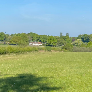
Go through the metal gate and out onto the lane. Turn right and ahead of you lies Nutfield cricket club; head around the boundary and cross over Nutfield Marsh Road, carrying on straight ahead, following the waymarked path over grass and picking up the lane that goes past farm buildings. Once you reach the metal gate and see fields off to you right and hedgerow to your left, turn left and take the path through the hedgerow and out onto a field with the carpark for the Mercer's Lake aquasports centre on your left. You have now left the TBP!


Head straight ahead across the field and you will pick up an obvious footpath that skirts around Mercer's Lake (I stopped about here for a snack and tea) and brings you out onto Nutfield Road. Take a left on the road and follow the road until you reach the fork with Cormongers Lane; take the right hand fork down Cormongers Lane (limited verge space, occasional traffic) and continue for about 200m. On the right is a footpath that also forms part of national cycle route 21. Take this path and follow it, passing Nutfield Marshes on your right, and into part of the Moors Nature Reserve. Eventually you will reach a juntion where to the right is a bridge over the railway, with a wooded footpath to your left. Take the footpath, which tracks uphill (moderately steep) until you reach the A25 again.
Once on the A25, turn right and follow the road, past the entrance to Oakwood Close, then cross the road to head down Redstone Hollow. This is a steep hill, but at least you’re going down it! Follow the road down, pass under the railway bridge and then turn right onto Brambletye Park Road. Follow this road all the way round until you see the entrance to Earlswood Station in front of you, and turn left onto Princes Road. Stay on Princes Road until you see the entrance to Earlswood Park ahead of you, then turn right onto to creepily named Asylum Arch Road (gives you a clue what Earlswood Park was used for at one point!). In front of you will be a tunnel that runs under the railway; we’re turning left onto A pedestrian byway that runs alongside Earlswood Park all the way down the the hospital. Wave at the lovely people who x-rayed and casted my arm!

You’ll note as you walk down this byway, and at various points on the rest of the route that this is part of the Millennium Trail. This trail is 18 miles, running from Banstead down to Horley’s very own Riverside Park. It’s on the to do list- I reckon I could do that in a day!

Anyway, head straight over the roundabout by the hospital and into Whitebushes. I usually go straight through Whitebushes, following Bushfield Drive, cutting through on the paths behind houses to reach The Brow Convenience shop and then straight over the road into Green Lane. Green Lane becomes a wide footpath / cycleway which you can follow all the way to Honeycrock Lane, crossing Salford’s Stream and passing Dean Farm (on the left) along the way. Head straight over Honeycrock Lane and down past Perrywood Sports ground to pick up Gail Lane. Good old Gail Lane will bring you back to Cross Oak Lane and from here it’s familiar territory back to the station. Hurrah! (in fact, two hurrah’s, one for finishing the walk, another for finally finishing the write up!)
Here’s the map....

Now, I know I usually end with a photo of the cat, but she‘s been suspiciously absent of late. I think she’s found an alternative source of grub and is alternating between houses. Dirty stop out. On that basis, here’s a photo of my friend’s dog wearing a headset. Y’know, working from home.


Comments