
Lockdown walking 5: Copthorne explorations
- Kate Cheema

- May 22, 2020
- 5 min read
Updated: May 31, 2020
10 days. 10 whole days off work. As today should have been a day of travel to a half term holiday in Rome, I thought I’d kick my 10 days off with some bipedal travel to a place I’ve never walked to before. Chose to head south east towards Copthorne via Burstow and back in a loop of about 23km (14-ish miles) which took me 4 and a half hours.
I started off, as ever, from near Horley station, heading down Balcombe Gardens off the Balcombe Road, taking a right on the bridle path at the end and following it past the Four Winds bungalow and over a small bridge. Immediately after the small bridge, turn right and straight out onto Haroldslea, going straight ahead (you are parallel with the Smallfield Road at this point) until you meet Peeks Brook Lane.
Plenty of wildlife down Haroldslea today; peacocks, young deer foraging in the meadow, horses and a family of goldfinches (wasn’t quick enough to get a photo of them!)


When you meet Peeks Brook Lane you have a choice; there are two ways to get to Burstow from here. For the more scenic one, take a left, follow the road around onto Perrylands Lane, go under the motorway and then take the lane on the next right. This is our old friend the Tandridge Border Path and you can follow this over two stiles, across a large field and through hedgerow to come out on Church Lane. However, that ‘large field’ generally has a herd of cows in it (and I’m afeared of cows) and the one time I ran into the landowner it was not a happy experience (despite it being a well waymarked permissive footpath. Hey, what can you do?!).
If you’re a giant wuss like me, take a right at Peeks Brook Lane, head up past the wonderfully named ‘Von Wolf’ canine training centre, follow the path through the roughs and then carry on up Peeks Brooks Lane through Fernhill, passing the Touchwood Chapel (formerly a Baptist Chapel, now a private residence) on your left, and then Gatwick House (built in 1876 as a country house and which combines the Gothic Revival and Neo-Georgian styles). Fernhill was the site of a fatal plane crash in 1969; usually its right under the Gatwick flight path and is pretty noisy but today was very peaceful.
Not far after Gatwick House, take a left onto Church Lane. Initially a road that takes you over the M23, it eventually turns into a footpath that skirts the garden of Burstow Lodge Manor and come out more or less at the junction of Church Lane and Church Road (the TBP option also comes out around the same place). Turn right up Church Road.


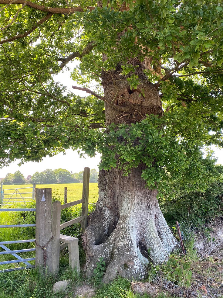
I love Burstow; such a pretty place, dripping with history. My favourite Burstow fact, other than it being around for, like, a thousand years, is that when it’s most famous vicar John Flamsteed (the first astronomer Royal, a scientific rock star of his day, the Royal Observatory at Greenwich is named after him) died he left money for the provision of two warm coats for two poor people of the parish to be given every St Andrew’s day. I’ve always wondered if the Churchwardens at St Bartholemew‘s still make that provision; I guess the money’s probably run out by now.


Anyway, carry on following Church Road (trying not to get house envy) all the way until it meets Antlands Road. Cross the road and then head diagonally straight across the field of corn on your left.

Passing through the hedgerow, this brings you out into a builders yard (?); turn left and go out of the gate, following the path until you come out into a huge field dotted with trees. There is some way marking, but it’s easy to miss. Basically, as you come out of the builders yard, turn 90 degrees and head straight across the field. Once you get to the far boundary you should be able to pass through a gate onto a road; if that’s not obvious, just follow the boundary line (likely to the left) until you find it. This is Copthorne Bank. Turn right and follow the road, passing the Cherry Tree pub, and taking the second left down Clay Hall Lane.
Follow the lane (more house envy!) until you reach the turning for ‘Roundhouse Farm’ on the right. Take this turning and follow the path. It’s a bit rough underfoot in places so be careful. The path takes you round the back of houses and out onto another lane. At this point turn right and head onwards until to reach a main road (this is the A264); cross over and almost immediately turn left following the signs into woodland. Keep going straight on until you reach a three-way waymarking. You are going to follow the Sussex Border Path.

Follow this path for a little under a mile. Beautiful views across the countryside here, the North Downs winking away in the distance and not a soul to be seen for miles around!

When you reach a small hamlet of houses, you’ll see a waymarked footpath heading off to the right. Take this and mosey along the path which bisects wide open fields, until you reach a small cluster of houses apparently called ‘Old Rowlands’ (probably used to be a set of farm buildings). Turn right and follow the footpath straight ahead, twisting and turning through woodland until you get back to the A264.
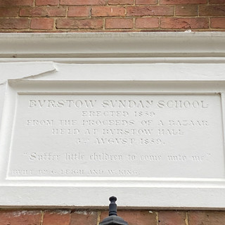
Cross over the road and turn right; after about 50 metres take a waymarked footpath on the left which takes you onto a residential road. Follow the road and round to the right (passing a primary school); when you meet the next road, cross over it and head down the footpath between houses. Carry on this footpath (it has three ‘sections’ bisected by roads) until you reach a main road- there should be a convenience shop immediately on your left. Turn left and follow the road to a T-junction; cross the road and turn right.
Follow the road until you reach a waymarked footpath on your left; take this, going down a short lane which then has the start of a footpath across fields at the bottom of it, to the left of a gateway to a private drive. Take the footpath through a field, over a stile and then follow the right hand boundary of the next field. About half way along it is a gap in the hedge into another (rather barren!) field; head diagonally across it towards farm buildings.

Keep going past the buildings (which turn out to be a warehouse!) and follow the long drive back down to Antlands Lane (the field of corn you walked through earlier is on your right....).
From here I retraced my steps so I won’t bore you by describing it backwards!
Really pleased to find some new paths around Copthorne and loads more to explore!! Here’s the map:

We end as ever with the cat.... looking pleading this time.


Comments