
Dorking to Horley
- Kate Cheema

- Sep 13, 2022
- 3 min read
Updated: Mar 9, 2025
Ah, the first walk (of any distance) of Autumn, probably my favourite time of year. You will note that this is not the next stage of the Vanguard Way, I just haven't had the time to commit to it. But I was not be deterred from getting a good long route under my belt; but what to do outside of my usual haunts? I wanted to stay local, but also walk somewhere new!
To help me with this conundrum, I turned to the very excellent Slow Ways website, an organisation with an ambition to create a national walking network that connects all of Great Britain's towns and cities. It really is a great resource, providing detailed surveys and downloads of routes between settlements that are 'verified' by volunteer walkers who walk the route and review it; three reviews and recommendations for inclusion and the route is in! Would really encourage folk to take a look and get involved if you can. Anyway, I combined a new walk with the chance to review a route, in this case walking from Dorking back to Horley (this route is the last one on the SW website that needs to be fully reviewed to complete a full linkage of routes from London to Brighton).
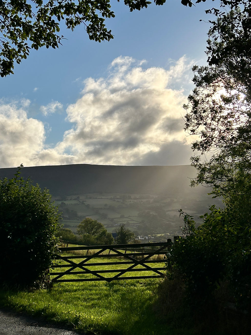
The good web-developer-him-indoors, and a couple of rugby playing teenagers, dropped me off on a foggy September morning, en route to their match, in Dorking High Street, mere metres away from the start of the route. The first 4km were surprisingly 'up', mainly on concrete and made paths, but it soon returned to the flat rolling pasture of the Weald between the North and South Downs.


A misty, damp morning made the first hour or so very atmospheric, heading east over the railway towards Brockham, with the church spire of the village looming through the mist. I always marvel when I walk locally how remote everything feels, even as the mist obscures planes taking off every 2 minutes from Gatwick, just 10 miles distant. This is working land, with arable and livestock pastures (thankfully only one field of cows!) and a fair share of stables and studs to represent the equine interests of the county!
As the mists cleared (and I regretted wearing long leggings) I came into Leigh, a charming little village with two very enticing looking pubs; but 1030hrs felt a little early for a pint so I carried on past Leigh's beautiful little church, pausing to listen to my first hearing of God Save the King from its congregation, which sounded as odd as many would expect, and back out onto the rolling sheep fields. Passing through Bell Copse I came upon the remains of an old lime kiln, probably part of the wider lime burning activity in the area to support with fertilisation of agricultural land and possibly building work.


I turned south, passing the excellently named 'Stumbleholes' ('Little' and regular!) which are largely horse stables, passing the time of day with riders out in the late morning sunshine. Dropping down towards Norwood Hill, came the second climb of the day, coinciding with a field of cows and therefore a rigorous cardiovascular workout! Avoiding the perils (but not the interest) of the bovine residents, I clambered over a rather shaky stile and onto a country lane before cutting off the road across to Brittleware Farm (such great names for farms in these parts!). The path from here towards Westlands Farm, just off the A217, was very overgrown and in retrospect I wish I'd taken a slightly more circuitous, but altogether clearer path. Turns out my long leggings were useful after all as a protection against the waist high stinging nettles. Thankfully, despite warnings to the contrary, they were not needed to protect against the vagaries of free range chickens!
Westlands Farm is opposite the Black Horse pub on the outskirts of Horley, and the final couple of km just took in urban streets and a stop off at Lidl. Not especially exciting!
All told, a good 20km of reasonably easy walking across a typical English country landscape, well served by hostelries and points of interest. The terrible state of some stiles and just one small bit of path was unfortunate, but there are ways around the rubbish path and alternative means of traversing field boundaries!
I've popped a map under the photo below, but you can also download the GPX from the Slow Ways website- get involved to help build a walking network across Britain!


Comments