
Eden Valley Walk: Edenbridge to Tonbridge
- Kate Cheema

- Jul 10, 2020
- 5 min read
Updated: Jul 11, 2020
I ordered myself a new map for the next stage of the Greensand Way (never wanting to be too reliant on tech and a GPS signal), spread it all out on the living room floor and started to get excited at the possibilities of new routes and hidden corners. I had a couple of days off work so took the opportunity to break out the spanky new OS Explorer 147 (Sevenoaks and Tonbridge) and have an explore of a new trail.
I chose the Eden Valley Walk, a 16 mile trail that starts a couple of miles south west of Edenbridge, close to the Kent/Surrey border, and ends at Tonbridge castle. I do love a castle and this trail runs close to no fewer than three and a stately home to boot. Too much to resist! I didn’t start at the beginning, which is at Cernes Farm on an intersection of the Vanguard Way and old friend the Tandridge Border Path. This was purely because to get to the start the best train station is Lingfield and a couple of miles extra walk; not only am I lazy but the trains to Lingfield took forever and I spend enough of my life lurking at train stations. So instead I got a train to Edenbridge via Redhill and walked the 1.5 miles to pick up the trail close to Edenbridge Town station (yes, Edenbridge boasts two stations!). In all I covered just over 24km (about 15 miles) train station to train station, which took me 5 hours including a short tea break.
Its worth stating up front that this is without a doubt the worst waymarked trail I have ever followed. Whilst Kent County Council have done a cracking job of maintaining and marking footpaths generally, which one was actually the EVW was, at some points, anyone’s guess. I got turned around twice, in part due to just having so many options to follow. Anway, map and app a must. Although the second half is better marked than the first.
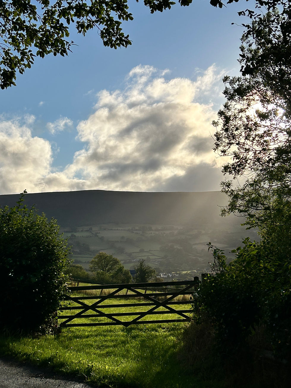
The first part of the trail is mainly open fields and tracks and there are some glorious views over rolling hills; this is the north side of the High Weald and an Area of Outstanding Natural Beauty (AONB). A few fields of livestock, mainly sheep, and lots of arable. Nothing so lovely as walking though open country with birds warbling against the gentle susurration of wheat blowing in the wind. Poetic eh?

The trail takes in everything you‘d hope a long walk in Kent would; picture postcard cottages, oast houses and, if you look carefully, hops as well. The landscape was shaped by various industries over the centuries including iron smelting, coppicing, brewing (nom nom), haymaking and a variety of agricultural activities. You can see this in the buildings and the land itself and I love to imagine thousands of years of social history bound up in the soil under my feet.

Just past the oast houses above the trail heads through Lyden’s Farm. You may be fooled into thinking the trail hits a dead end, but rest assured you just need to saunter nonchalantly through someone’s garden. Honest.
The first village on the trail is Hever, a beautiful little hamlet with a tantalising looking old world pub. I thought it would have looked bad to stop for a pint at 10 in the morning so didn’t go in; I slightly regretted this an hour or so later. Close to Hever village is Hever Castle, the childhood home of Anne Boleyn. Sadly you don’t get a look at the castle, its nestled behind trees, but you walk along the boundary of the jousting field and take in a good proportion of the estates extensive trails and woodlands. And a field of alpacas.


After leaving the Hever estate behind the trail heads uphill to Hill Heath; don’t worry its not too strenuous, and by the time you get to the tiny hamlet of Wat Stock you are amply rewarded by gorgeous views to the north over the Kent Downs. I stopped for tea at a strategic viewing point with a bench and switched on the AR function on the OS app to help get bearings.....

As you can see, this spot isn’t too far south of Chiddingstone, where there is another castle (although more of stately home with a 19th century vanity project). Again, no view from here but an easy diversion from the trail should you be so inclined.
A very pretty byway tracks around the hill for a while until you come down towards Penshurst Place. This is a Tudor house, once owned by Henry VIII, and quite a spectacular sight. I visited Penshurst as part of my GCSE history course and still remember quite a bit about the architecture; later in life I went to a wedding there and bored the pants of anyone who would listen with my fascinating facts. I won’t make the same mistake here.

Walking around the house you pass through a churchyard and then under a half timbered house, bearing the motto ‘My flesh also shall rest in hope’ (Psalm 16:9, KJV) and then head through the estate gates and along the drive towards the public entrance for the house and gardens.

The Penshurst estate is really accessible with lots of well marked circular walks to help you get a feel for this spectacular bit of the world. You’ll follow a bit of the local trails as you skirt the wall of the house and gardens and then away and up towards Well Place Farm. This was by far my favourite bit of the trail; the history of Penshurst and the views from the hill over Weald and Downs, accompanied by a bit of sunshine, all combined to make it a very pleasant couple of miles. The trail descends gently to Killick’s Bank and then towards the river which you follow for some time.

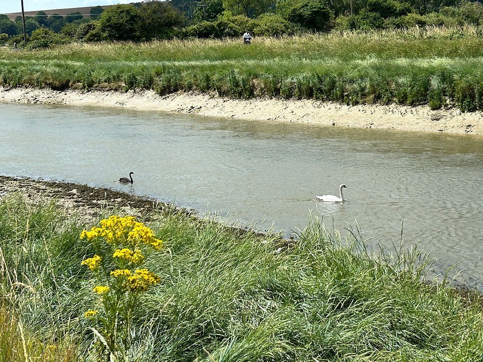
You may think that this is the River Eden, titular river of the trail, but you would be wrong. This is the River Medway; the River Eden is a tributary which you crossed on the way out of Edenbridge but has otherwise remained distinctly away from the trail. The trail hugs the river more or less all the way up to Haysden Water at which point the trail passes under the A21 and into Haysden Country Park. This is a great place to explore with old railway bridges, hidden waterways and pretty landscaped bits to explore.


From this point it becomes clear you‘re headed into a more suburban environment as you reach the edges of Tonbridge and across the playing fields to come into Tonbridge proper; you arrive in the town next to the local swimming pool. This is the wharf area which was once an important part of the economy of the town when materials as coal and lime could be transported in, and gunpowder, hops and timber carried downriver to Maidstone and the Medway Towns (and the Thames). The advent of the railways put paid to that.
The final castle of the EVW is Tonbridge Castle built by Richard Fitz Gilbert in the 12th century, where the trail ends. Its more or less a ruin now although the gatehouse is in reasonable repair. The station was in the opposite direction and after lunch by the river I didn’t fancy a detour. But I managed a picture of the medieval walls looming over the Medway.

All round a thoroughly pleasant way to spend the day; its nice to more or less get a whole trail in in one go, and waymarking issues notwithstanding I would recommend this as a great introduction to a glorious part of Kent. Obviously start later than I did and visit the pub in Hever. Here’s the map....

This post marks the start of an ‘other walks’ section of the blog which will be a random hodgepodge of posts as and when I do them.
In time honoured tradition.....here’s the cat. Ironically walking on my map. Sigh.


Comments