
Horley to East Grinstead
- Kate Cheema

- Nov 1, 2022
- 3 min read
Updated: Mar 9, 2025
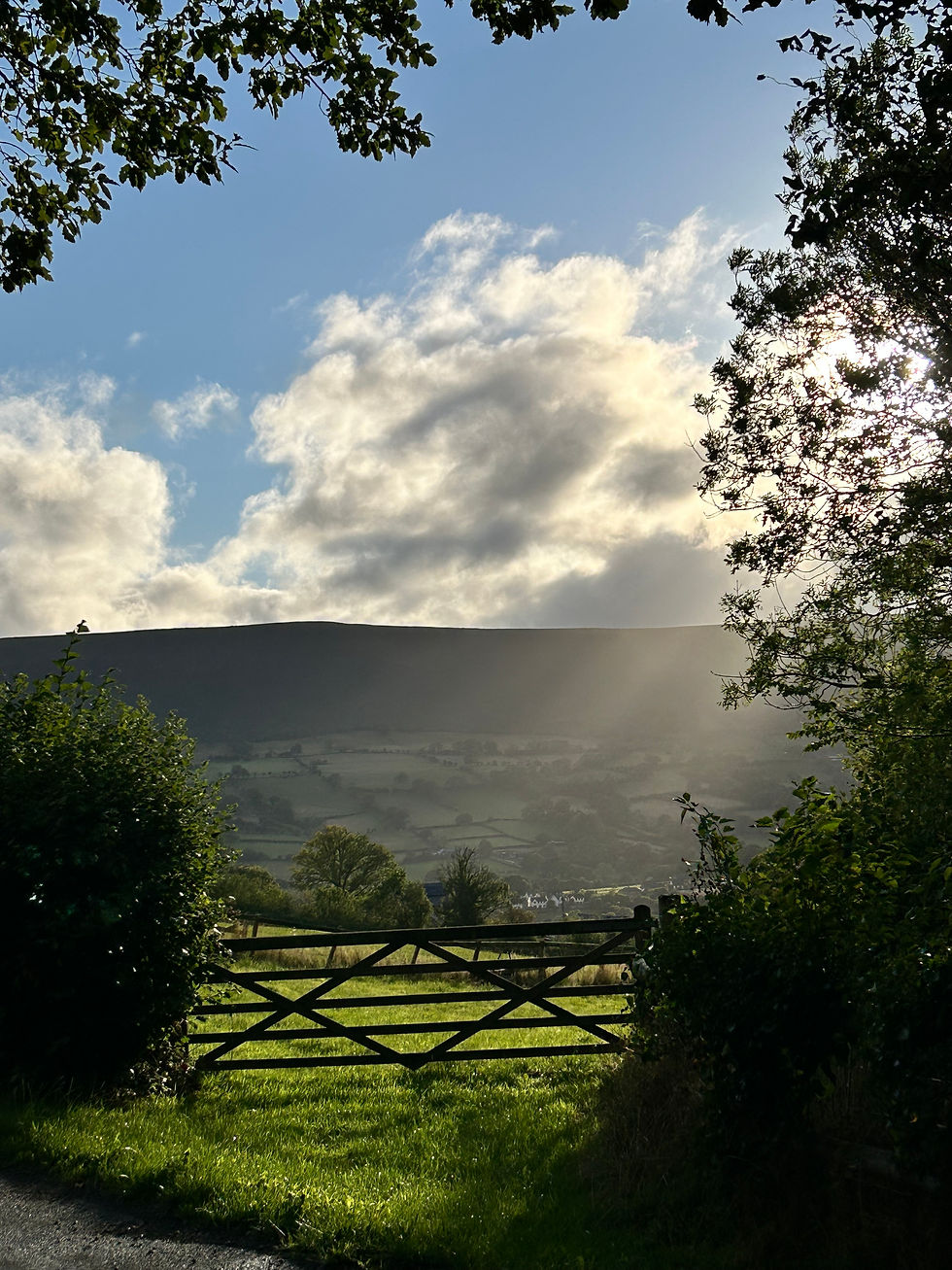
My efforts to complete all the Slow Ways routes linked to Horley continues with this 15km (9.5 miles-ish) jaunt over to East Grinstead, taking in a swathe of hitherto undiscovered footpaths and showcasing some beautiful woodland. I always marvel how much peace and open country is on my doorstep, despite that doostep being a 20 minute walk from an international airport and not much further to a major motorway!
For anyone interested, this is the 'Horeas' route from the Slow Ways site, which 'officially' starts from top entrance of Horley station on Victoria road. From here, head east towards the bridle paths at the end of Balcombe Gardens and follow the narrow footpaths out to Peeks Brook Lane, from whence you cross over the roar of the M23. I really love this little bit of Horley; it's directly under the flight path for Gatwick, and constantly reminded of that fact every 2-3 minutes, but it has the clearest signs of the town's agricultural past. The myriad of footpaths show the literal ways of life of previous generations before the age of car ownership, well worn routes between churches, cottages and farms. And the late autumnal day, in glorious sunshine, gave a chance to wander in the colours of the morning and ruminate a little on what a slower pace of life might feel like. Don't worry, I wasn't being misty eyed for days of yore; as if a single woman could roam the byways of Surrey at leisure and ponder such questions in the way I take for granted now (for more on this subject I recommend Wanderers: A History of Women Walking).

Crossing Antlands Lane at Shipley Bridge, the route crosses the road and heads southwards towards Copthorne. Rather than tracking the road (which has no footpath alongside it) the route instead joins a footpath to the left that brings you behind properties, across fields and ultimately out onto Shipley Bridge Lane and then onto Copthorne Bank, the main road through the village. Copthorne is a pretty little place and on this route ideally situated for a restorative brew!


Coming out of Copthorne the route meets the A264, really not the most desirable walking companion, so it almost immediately tracks off to the left, heading north towards Snow Hill and crossing through some really delightful, and at this time of year riotously colourful, woodland. This section feels like you're taking the long way round, but it really is kinda the point of a Slow Way; not necessarily the most direct, but definitely more enjoyable.
Crossing back over the A264, the route enters what looks like private property; I went a bit wrong here and ended up at the end of someone's garden; stick to the left and follow the fence line and you can't go wrong. It's signed as a footpath, I just wasn't paying proper attention! Once you've navigated that you stumble upon the top end of Furnace Pond. It's absolutely beautiful but completely closed off to anyone but fishermen with the right kind of permit (grr). The name 'furnace' is common in these parts; Furnace Pond sits within Furnace Wood and reflects the Wealden iron industries of the 16th and 17th centuries. The area was also known for its charcoal burning, long before the coming of the Industrial Age.

After just a little more grousing about a lack of a right to roam in England, I emerged onto a small road which runs into Felbridge; a very short walk along this road and then a right turn back onto footpaths brought me back into open countryside, with yellowhammers in the hedgerows and fabulous view across the to the North Downs. Joining the number 21 cycle route I passed the Jacobean manor house of Gullege (referenced in a previous blog) which, I noticed this time, has a charming little Millenium Woodland next to it, literally next to the path. I paused here for a slurp from my flask and learned it was a miniature nature reserve developed with the local primary school and used for nature walks and the like. It's on private property but the casual visitor was made very welcome.


Continuing on the path past Gullege you soon meet the Worth Way (also previously discussed) which in just a short distance leads you into East Grinstead and the formal end of the Slow Ways route. I walked an extra 10 minutes into town proper, met up with the good web-developer-him-indoors (who henceforth wishes to be known as the good-but-unrepentant-purchaser-of-motorcycles-him-indoors) and then holed ourselves up in the very excellent Engine Room for an hour or so.
Altogether a thoroughly satisfactory walk, excellent scenery, a pleasant ending and just far enough for a sense of accomplishment. Recommended!
Map for reference, but you can download the GPX from the Slow Ways website (linked above)

Comments